ANCHORING
Recommended Anchoring Areas:
Mouth of the New River
New River Cut – South of the turn at Bahia Mar.
Northeast side of the Las Olas Bridge.
Sunrise Bay
Western portion of Lake Santa Barbara – this is where the parade turns around.
No Anchor Zones
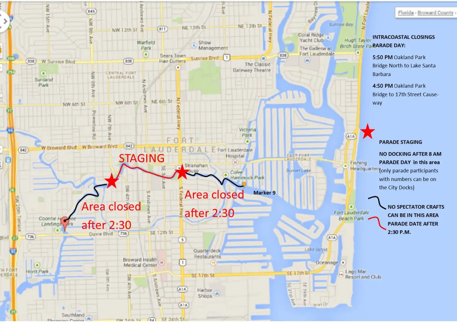
The New River will have No Anchor zones and will close for boat traffic at 2:30 PM.
Birch State Park is a No Anchor zone.
We will be working with many law enforcement agencies and will also provide “control boats” (civilian boaters that have attended safety training and information seminars regarding the parade).
Closing of the Waterways Parade Day:
Make sure you are anchored by 4:00 PM SOUTH OF OAKLAND PARK TO THE TRIANGLE as the Intracoastal Waterway will close to all boat traffic with parts of the Intracoastal closing as early as 4:50 PM (South Route – Intracoastal). As you travel north closure times are later (5:50 PM Oakland Park Boulevard to Lake Santa Barbara). See a virtual map with anchoring locations
• City Docks closed to non-parade boats 8:00 AM Parade Day
• 2:30 PM – The New River (Davie Blvd. to Mark 9)
• 4:40 PM – Triangle (East of Mark 9 to Triangle)
• 4:50 PM – The Intracoastal Waterway will be closed SOUTH of Oakland Park Blvd.
• 5:50 PM – The Intracoastal Waterway will be closed NORTH of Oakland Park Blvd.
REMEMBER YOU CANNOT ANCHOR IN FRONT OF A CONTROL BOAT – but a control boat can anchor IN FRONT of your vessel if needed.